How to choose a neighborhood in an unfamiliar city
A complete checklist of environmental factors: from walkability and noise to your weekly time budget. In 30 minutes you can build an accurate portrait of a neighborhood and stop playing roulette.

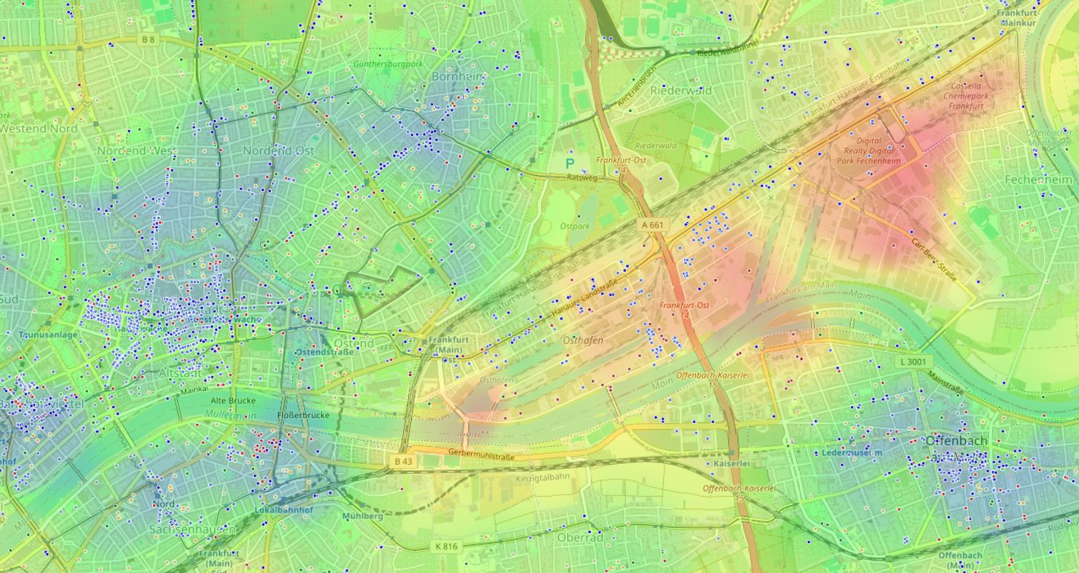
What matters most often stays outside the apartment door
People move based on price per square meter, layout, and condition of the renovation.
Life satisfaction depends largely on what surrounds your home every day.
The paradox is clear: what matters most gets left out of the equation.
You'll learn how to quickly evaluate any neighborhood without "living there for a couple of months" or relying on gut feelings.
Why conventional methods don't work

We're used to evaluating a neighborhood in fragments: "there's a park — good," "school nearby — great." But a city is a system. A park five minutes away on foot can be devalued by a roaring highway, and a subway around the corner — by the lack of a decent supermarket.
The urban environment affects us continuously. By ignoring its balance, we accept chronic noise, extra hours in transit, and constant background discomfort.
Environmental quality isn't a subjective "I like it" — it's a measurable category. What used to be available only to urban planners with GIS maps can now be done for your own address.
"What matters most in a city isn't the buildings, but the people and their everyday experience. If the environment makes you spend an hour getting somewhere just to buy bread — that's a planning mistake you pay for with time and health."
Myth: park and subway nearby means perfect
Finding two or three perks is enough
Our brain latches onto bright objects: a park, subway, a beautiful waterfront. Against that backdrop, it's easy to miss noise, industrial zones, weak retail near home, or an inconvenient commute.
The balance of positive and negative factors matters
A modest neighborhood with developed infrastructure and quiet routes can be more comfortable than a home by a park if there are highways, nightclubs, or empty ground floors nearby.
Don't evaluate individual points — evaluate the overall comfort layer: how much time regular routes take, where useful amenities are, and whether the address falls in zones of acoustic or environmental discomfort.
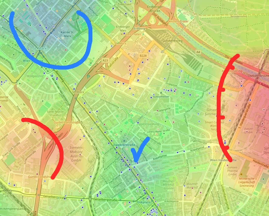
The "Quiet and calm" heat map immediately shows which areas win through environmental balance and which are overloaded with roads and industrial zones.
Accessibility is measured in minutes, not kilometers
"Nearby" is a flexible concept. Fifteen minutes on foot past an industrial zone and fifteen minutes through a square give fundamentally different experiences.
The main quality parameter is time spent on regular routes. Isochrones — lines of equal travel time to key destinations — show your real weekly budget better than kilometers.
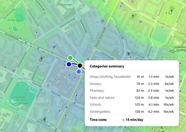
Two neighborhoods can both be "near the subway." In one, it's five minutes to the station through a noisy intersection; in the other, ten minutes down a quiet alley, but with a market, park, and kindergarten nearby. Formally the first is closer, but the second may save hours every week.
Don't ask "is it far?" Ask: "how many minutes per week does it take?"
Weekly travel time costs
Total hours per week
Comparing weekly time costs helps you see which address seems convenient and which actually is.
Five environmental factors you can't ignore
Basic infrastructure
Pharmacy, grocery store, bus stop, and ATM should be within a real daily radius.
Noise and ecology
Highways, factories, and nightlife spots affect sleep even when you've stopped noticing them.
Green spaces
What matters isn't a park on the map, but its size, lighting, the route to it, and whether you'll want to go there regularly.
Transport resilience
One route makes a neighborhood vulnerable. Subway, buses, and convenient exits protect against disruptions.
Social environment
Lighting, active ground floors, and visible courtyards often speak more accurately about safety than advertising.
Neighborhood evaluation algorithm in 30 minutes
Follow one checklist for all candidates. That way comparison will be fair, not emotional.
Define priority categories
Make a list of 5–7 destinations critical to your lifestyle: work, school, park, gym, coffee shop, or doctor.
Build accessibility isochrones
Mark where you can reach in 15 minutes on foot and 30 minutes by public transit.
Overlay the environmental balance layer
Compare useful amenities with sources of noise, traffic, odors, and nighttime activity.
Calculate weekly time costs
Multiply one route's time by trip frequency. The total shows the real price of an address.
Compare candidates on a single scale
Sometimes a neighborhood 10% more expensive saves five hours a week. That's not overpaying — it's buying time.
A systematic approach without manual counting
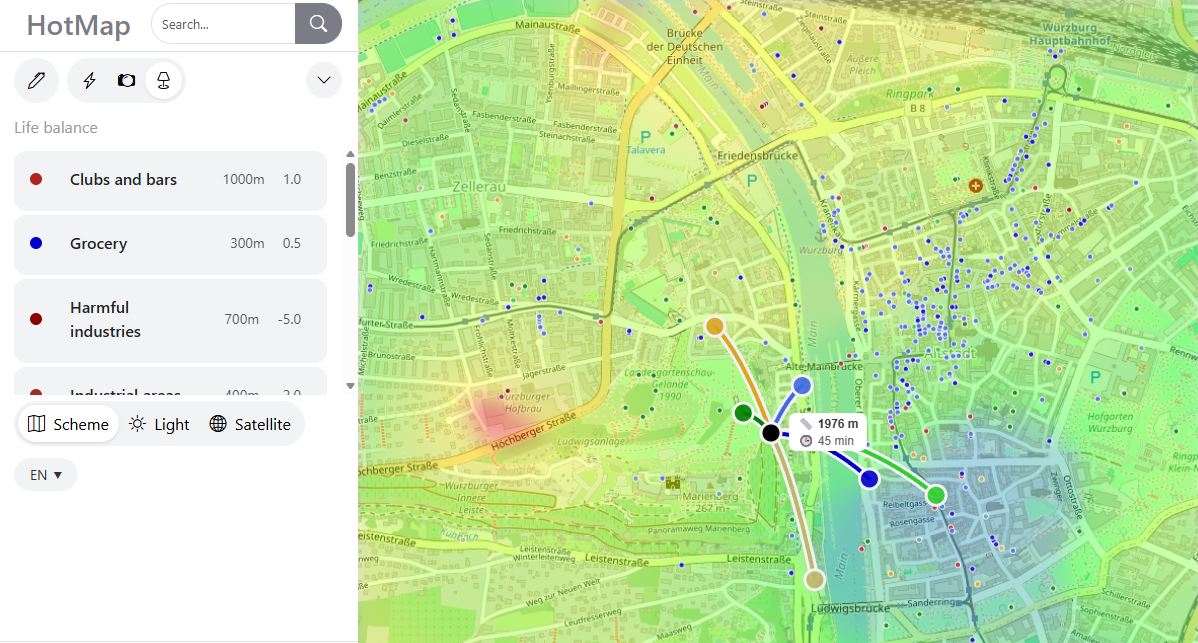
Manual analysis requires time, up-to-date data, and discipline. You need to find points on the map, understand influence radii, weigh pros and cons, and not get the coefficients wrong.
HotMap automates this mechanics. The app builds an environmental balance heat map based on dozens of object categories. You choose a scenario — "Nightlife," "Cultural center," or "Quiet and calm" — and see how the city is colored.
Intuitive guesswork turns into a transparent system: you immediately see where green zones match your needs and can compare several addresses objectively.
The "Quiet and calm" mode helps find local comfort oases and not confuse a neighborhood's marketing description with its real environment.
Comfort isn't created only inside the apartment
Every day you'll interact with your surroundings: walk to the bus, stop at the bakery, breathe the courtyard air, come home in the evening. When these micro-moments are well arranged, they energize you rather than drain you.
Start with your own priority map. Even a simple checklist and half an hour studying open maps will give you an edge over most newcomers. And when you have your first candidates, turn on systematic analysis — and your next move will be a conscious step, not a leap into the unknown.
Frequently asked questions
Can you trust heat maps built on open data?
Yes, as a basis for initial analysis. For critical destinations like schools or kindergartens, it's better to also check official registries.
How do you account for future neighborhood changes — new construction, factory closures, subway openings?
In manual mode you can add prospective points and change their influence radius. That turns analysis into a "what if" model.
What matters more: quiet or walkable access to entertainment?
It depends on your personal balance. The heat map doesn't decide for you — it shows trade-offs that usually stay invisible.