How to Find Undervalued Districts for Real Estate Purchase
Prices in top locations are already breaking records, but convenient, green, and well-designed districts often stay in the shadows. Let's explore how to search for such places using urban environment data — not rumors and trendy maps.

Not a list of addresses, but a search methodology
Buyers usually see the same districts: downtown, a few prestigious neighborhoods, and a couple of new residential clusters. Everything else feels like a pig in a poke, even though that's where locations with a better ratio of price, time, and environmental quality may be hiding.
This page shows how to find places with growth potential: look at walkability, weekly time budget, development plans, and environmental balance. The goal isn't to guess future prices, but to see the city more accurately than most buyers.
A good district isn't always the one everyone talks about
The value of time is coming to the fore. The 15-minute city concept no longer looks like utopia: neighborhoods where work, leisure, and everyday errands are reachable on foot are appreciating faster than the market.
But hyped locations are often already overheated. Quiet alternatives nearby may be more convenient, greener, and calmer — they just haven't made it into realtor rankings and urban myths yet.

"Walkability isn't just convenience. It's a fundamental factor that determines property value and quality of life in the long term."
The market increasingly rewards with money the places where people are genuinely comfortable — not those with just a loud name.
Where promising spots hide
The best is only downtown
The most interesting options are often found between an overheated center and faceless bedroom communities: infrastructure is already there, but hype-driven demand isn't.
Time matters more than kilometers
A district farther in a straight line may be more convenient thanks to express transit, proximity to a work cluster, or short daily routes.
Look at the balance
An undervalued district is a place where parks, schools, and cafés already outweigh noise, industrial zones, and empty streets — but the market hasn't noticed this balance yet.
Travel time vs. environmental balance
Two districts at the same distance from downtown
Example: Location A is 3 km from downtown, but the commute takes 35 minutes. Location B is farther — 5 km — but the subway is a three-minute walk away and the trip downtown takes 22 minutes. The market often undervalues the second spot in the moment.
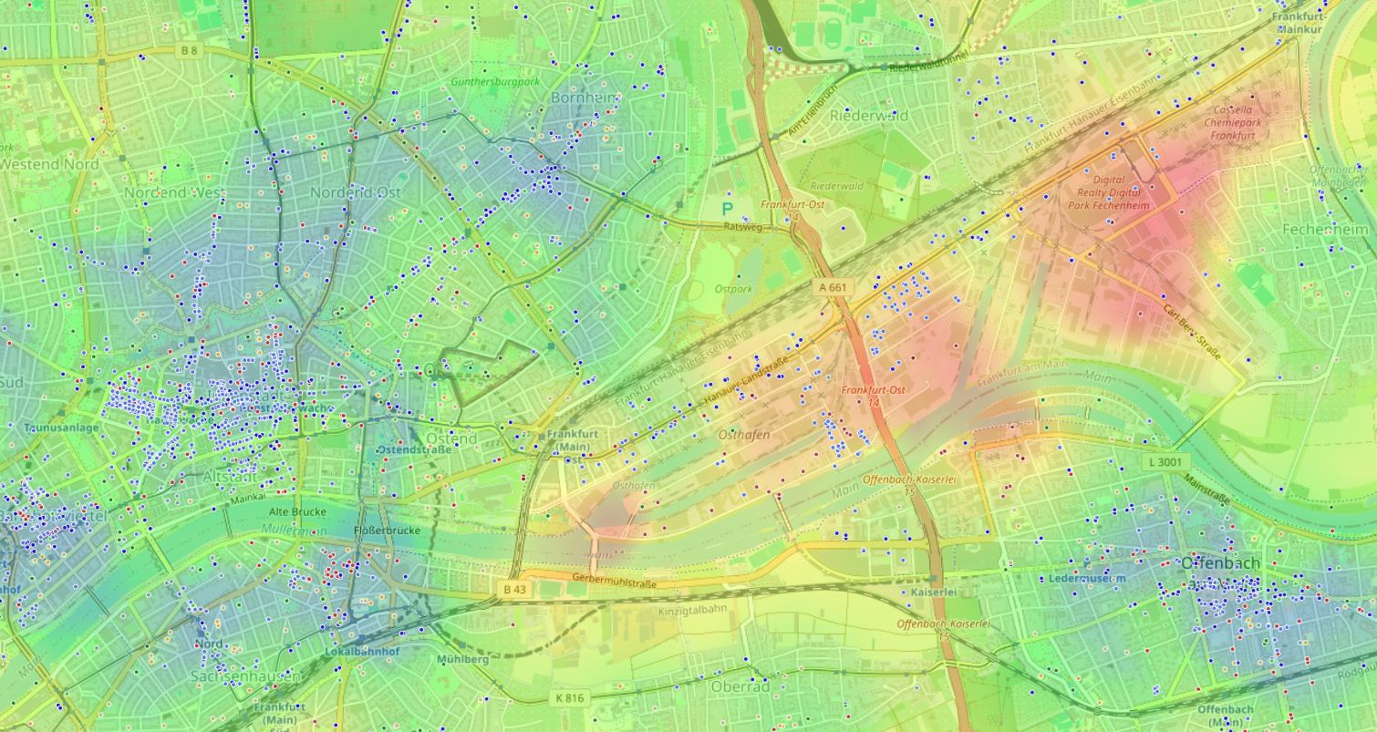
On a heat map, the junctions of green, quiet, and everyday-convenient zones are especially visible. Residential neighborhoods often hide there that haven't yet caught most buyers' attention.
Four criteria instead of stereotypes
A district's potential is better assessed by reputation-independent signs of the urban environment. These four criteria help separate an ordinary cheap neighborhood from a place that may grow in value.
Look for shadow zones around growth points
Cities develop in waves: after a park renovation or a new station opens, adjacent streets appreciate first. Buffer neighborhoods slightly farther out often remain undervalued for another 1–3 years.
Calculate your weekly time budget
Add up routes home — work — school — store — gym. Often a neighborhood near a commuter train is closer to your real life than a trendy residential complex stuck in permanent traffic jams.
Check the comfortable walking radius
Walk a circle of about 800 meters around the home. If there are more than 15–20 needed places inside, it's a potentially self-sufficient micro-district. If fewer than 5, trips will become a daily norm.
Consider plans, not just the present
Check the master plan and investment maps: where public spaces, transport interchanges, or business clusters will appear in 3–5 years. Today's quiet may become tomorrow's advantage.
Step-by-step search algorithm
Start with your personal life scenario. List 5–7 places you or future tenants visit at least once a week: work, school, supermarket, gym, favorite park.
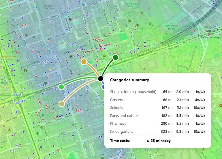
If gathering data manually is too labor-intensive, use tools that have already digitized the urban environment. HotMap shows walkability balance, time costs, and environmental impact on one map.

- Build a list of key places: not abstract infrastructure, but specific locations you actually use.
- Set a time threshold for each destination: for example, no more than 40 minutes to work, no more than 15 minutes on foot to school.
- Collect objective data on candidates: overlay needed places on the map and calculate actual travel time.
- Compare the price per minute: divide the cost per square meter by total weekly travel time and compare districts against each other.
HotMap automatically calculates time costs for any point and visualizes how well the surroundings match your priorities — without hours of manual searching.
The essentials
A district may look ordinary but be better in time accessibility. How to tell?
Compare weekly time budget and actual walkability. If the numbers are better than more expensive competitors and infrastructure is complete, you have a growth candidate.
Should you wait until a district matures?
Don't buy in a blank field without development plans. Look for places where basic social and commercial fabric already exists, but the price hasn't yet reflected future improvements. A good entry horizon is 1–3 years before key projects are completed.
Can such analysis be automated?
Yes. Geographic information solutions aggregate data on transport accessibility, environmental balance, and time costs on one map. They don't decide for you, but they make the process transparent and visual.