Walkability: Why Is It the Main Health Criterion for a City?
How to measure neighborhood quality through a simple step: 15 minutes on foot to the places you need, less stress, more health, and a clear picture for choosing housing, an office, or a business location.

47%
of residents in large cities spend more than an hour and a half a day commuting.
A city's health shows in the daily route
People whose everyday routes can be walked are 42% less likely to suffer from cardiovascular disease.
This is data from the American Heart Association for 2023. Walkability isn't a trendy urbanist term — it's a personal wellbeing tool: it shows how much energy the city gives back to you each day.
Why we're talking about walking again

The pandemic launched a global trend toward 15-minute cities. Everything a person needs every day — work, food, pharmacy, park — should be within 15 minutes on foot or by bike. This isn't utopia, but a pragmatic response to road overload and demand for a healthy lifestyle.
The problem is that most cities are still designed for cars. We choose housing by price and square footage, then discover: 40 minutes on foot to the nearest square through a six-lane highway. Thus begins life "from screen to screen," where the city becomes scenery outside the car window.

"Walkability isn't a question of convenience. It's a question of cities' survival. Make a street safe and pleasant for pedestrians — and you'll heal the economy, ecology, and neighborhood health in one action."
In practice this means: every ruble invested in sidewalks, crossings, and shaded alleys returns in rent value, café turnover, and reduced healthcare burden. Walking is the cheapest way to improve quality of life — and a city either encourages it or punishes it.
How walkability changes body and mind
Heart and blood vessels
30 minutes of walking a day reduces heart attack risk by 20–30%. A good environment turns these minutes into an unnoticed norm.
Mental health
Regular walking on green streets reduces anxiety. Noise without a quiet route, conversely, accumulates stress.
Social connections
On a pedestrian street you meet neighbors and acquaintances. That's how a sense of safety and belonging appears.
Neighborhood comfort can be seen on a map
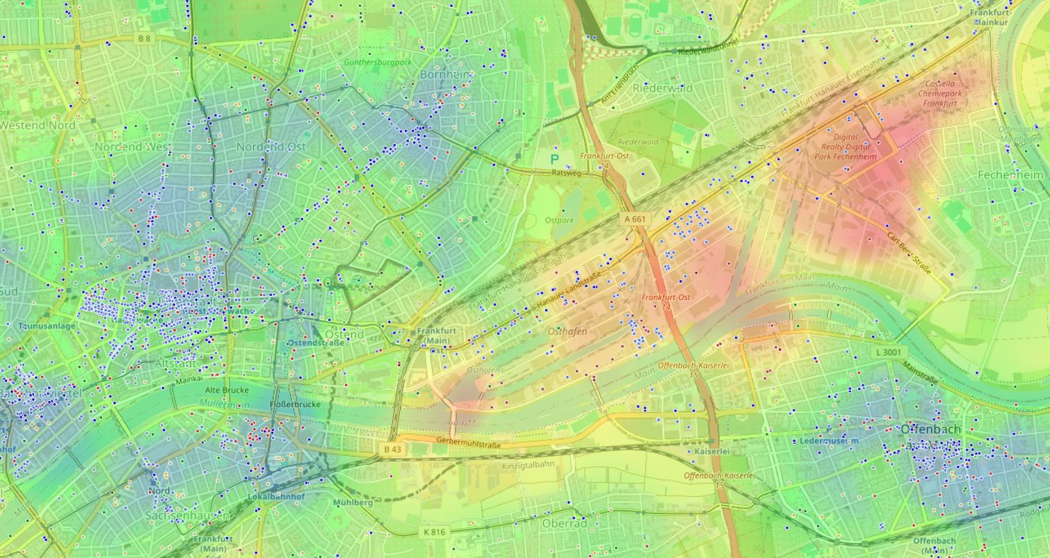
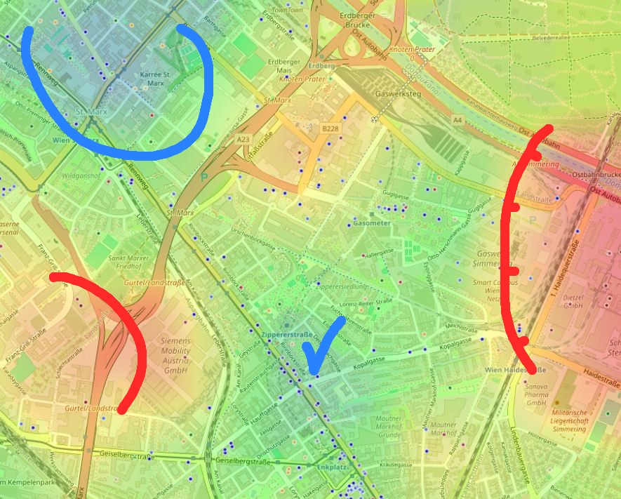
A heat map shows where walking is safe and convenient, and where the route breaks against highways, vacant lots, noise, and long detours. In a good environment a person walks on purpose, not to overcome obstacles.
Red — zones of low walkability and aggressive car environment. Green — neighborhoods where walking works as a daily habit.
The myth that a walkable city is inconvenient for drivers
Wide sidewalks create traffic jams
It seems that if you narrow the roadway and give space to pedestrians, cars will immediately stop and no one will get anywhere.
Calm traffic moves more predictably
Proper lane narrowing and raised crossings reduce accidents by 30–60% and cut chaotic lane changes.
This misconception persists because for decades cities were designed with one goal — to move cars faster. But research from Melbourne and Copenhagen proves: when infrastructure for people appears, flow speed can even increase, and ground-floor small business gets a multiple revenue boost.
A pedestrian street energizes the economy
Effect of pedestrian reconstruction
Index before and after (100 = baseline)
Pedestrian environment affects not only health, but urban business. The easier it is for people to stroll, stop, and return, the higher turnover at ground-floor cafés, shops, and services.
Example from Strøget in Copenhagen: after creating a pedestrian zone, café visitor numbers grew by 300%.
Where to start evaluating: three steps for practitioners
Choosing an apartment, office, or site for a new business is always choosing a daily mobility scenario. Here's a simple algorithm to avoid mistakes.
Draw 1.2 km
Place a point on the map and check a 15-minute walking radius. Count the real route along sidewalks and crossings, not a straight line.
Mark the essentials
Work, school, grocery store, pharmacy, park, and transit stop should fit your daily scenario.
Calculate the week
If the walk to work or school exceeds 25 minutes, you'll almost certainly start using transport.
Gathering data on dozens of objects manually is labor-intensive. You can spend an evening on maps and calculations, or look at a neighborhood through a tool that automatically calculates walkability and environmental balance.
When manual analysis hits a dead end
The main barrier in self-assessment is too much data. There's a pharmacy, but does it stay open late? A park nearby, but is there a busy road? School in 10 minutes, but two unsignalized crossings along the way.
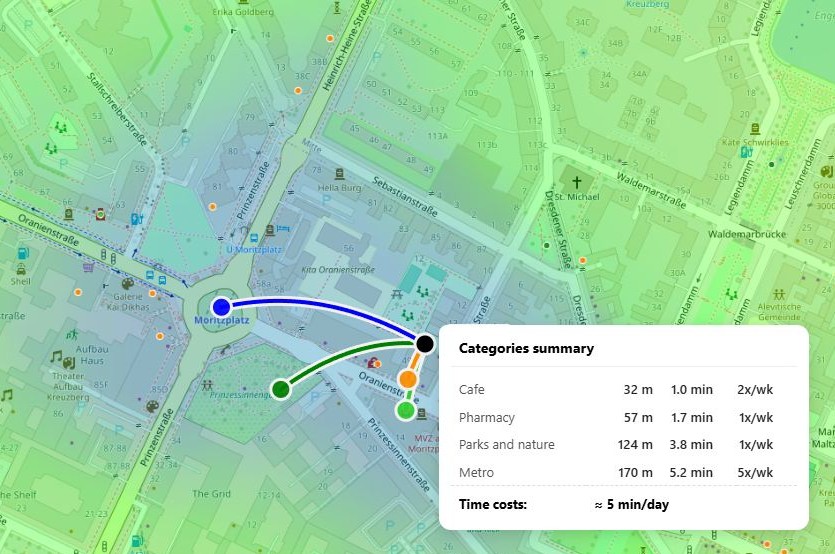
HotMap builds a walkability heat map and calculates time costs for a specific address. You choose important categories — schools, parks, cafés, transit — and in seconds see how green or red the future neighborhood turns out.
- Choose an address.
- Mark what matters to you: stores, subway, sports, quiet.
- Look at the heat map and accessibility arcs — and decide.
The city starts with a step
Walkability isn't an abstract term from urbanism textbooks. It's time spent getting home, number of neighbor encounters, quiet in the bedroom, and air in the lungs. Turning a city into a healthy environment is hard, but each of us can start with our own address. Choose a location where a step brings benefit, not drains energy.
Frequently asked questions
What walkability radius is considered good?
A comfortable benchmark is 15 minutes on foot, roughly 1.2 km along real sidewalks, to key daily places. Anything farther already requires transport.
Does HotMap account for terrain and real obstacles?
Yes, the system builds arcs and calculates time using the pedestrian network, not just a straight line. This gives a realistic picture, not an abstract circle on the map.
Can you compare several addresses?
You can enter addresses sequentially and compare heat maps. This shows where environmental balance shifts toward comfort and where toward an aggressive environment.