What Is a 15-Minute City — and Do You Live in One?
Check how much time your neighborhood takes from ordinary life.

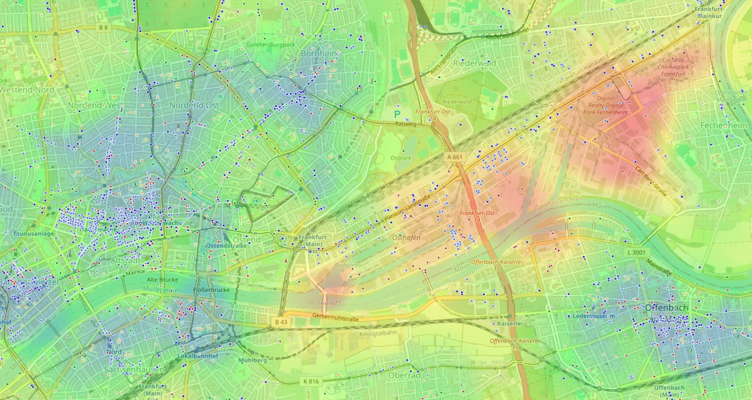
Have you ever counted how much time per week you spend just getting there?
To the pharmacy. To a decent café. To the park where you can breathe. To the school where you take your child.
Add it all up — and it turns out that several hours every week you spend not on life, but on moving toward it.
This article is about why this happens, what to do about it, and how to understand in 10 minutes how well your neighborhood is designed for people.

The city wasn't built for you. It was built for the car.
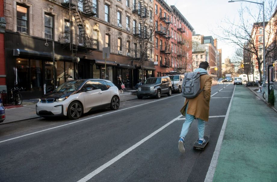
For most of the 20th century, urban planning followed one logic: separate everything into zones. Housing here, work there, retail in a third place. Between them — a road. And a car as a prerequisite for normal life.
This is called zoning, and it still defines most cities in the world.
The result is predictable: a person without a car is a second-class person. Even if you have a car, you still spend on logistics time that could be yours.

"We built cities as if movement were the goal. But the goal is life. Movement is only the means."
Speck spent years analyzing why some streets attract people and others repel them. His conclusion is simple and uncomfortable: most urban decisions were made from the car's perspective, not the person's.
What is a 15-minute city — and why it's not utopia
The idea is absurdly simple: everything necessary for life should be reachable on foot or by bike within 15 minutes.
A store, pharmacy, café, school, park, doctor, gym — not somewhere "downtown," but right here, in your neighborhood.
French scientist Carlos Moreno formalized this concept. But the idea is much older — you can find it in Jane Jacobs' work back in the 1960s, when she described lively New York neighborhoods working exactly by this logic.

The 15-minute city principle — all key places within walking distance of home.
Why it works — three mechanisms
Walkability changes time
When you walk, you're not just "spending time on the road" — you're already living: observing, thinking, meeting neighbors.
Mixed use brings a neighborhood to life
A neighborhood with housing, work, retail, and leisure at once becomes a self-sufficient ecosystem.
Time is a resource
Urban residents spend 1 to 2 hours a day on logistics. A 15-minute city gives that time back.
Myth: "A 15-minute city is a downtown privilege"
Such accessibility is only possible in a historic center where everything historically came together. On the outskirts and in new developments, it's unrealistic.
In reality
15-minute accessibility isn't about the center — it's about density and variety. Small neighborhoods on the periphery can also be designed this way — and some work exactly like that, even without a loud name.
The misconception persists because we're used to considering the center a "good place" by default. But the center can be noisy, overloaded, and expensive — and still poorly designed for everyday life.
Practical takeaway: evaluate not "center or not center," but the specific set of places around a specific point.
"A good neighborhood isn't the one that looks beautiful on a map. It's the one where you don't need a car for an ordinary Tuesday."
Five signs of a 15-minute city — check your neighborhood
Mixed-use development
Residential buildings neighbor cafés, shops, and offices. Not a shopping center on the edge, but functions woven into the neighborhood fabric.
Pedestrian infrastructure
Proper sidewalks, lighting, convenient crossings. Not "you can walk," but "you want to walk."
Transit nearby
A stop no farther than 400–500 meters. Frequency — no less than once every 10–15 minutes at peak hours.
Green spaces
A park, square, or boulevard — a place you can go without a reason. Green access is linked to residents' mental health.
Basics within 15 minutes on foot
Pharmacy, grocery store, school or kindergarten, medical clinic. Not "somewhere in the district," but right near your home.
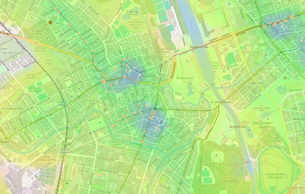
The heat map shows concentration of needed places: green zones mean high accessibility, red — its absence.
How to check your neighborhood in 10 minutes
You can tell intuitively whether you live in a 15-minute city. But intuition often lies — we get used to discomfort and stop noticing it.
Here's a simple algorithm:
Make a list of "weekly points"
Write down 7–10 places you visit regularly: store, pharmacy, café, work, park, doctor, school. Not an ideal list — a real one.
Measure walking distance
For each point, see how many minutes on foot from your home. Not "as the crow flies," but along the real route.
Calculate weekly time
Multiply one-way time by 2 and by weekly visit frequency. Add everything up. This is your "logistics budget."
Look at the blank spots
Which categories aren't within walking distance at all? Those are your neighborhood's weak points.
Compare with alternatives
If you're thinking about moving or want to understand if it can be better, compare several points by the same criteria.
Key idea: a 15-minute city isn't an abstraction. It's a specific set of places at a specific distance. And it can be measured.
Look at your neighborhood from a different angle
Everything described above can be done manually — tables, measurements, calculations. It works, but takes time.
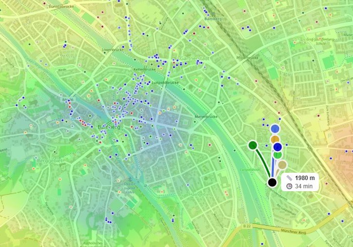
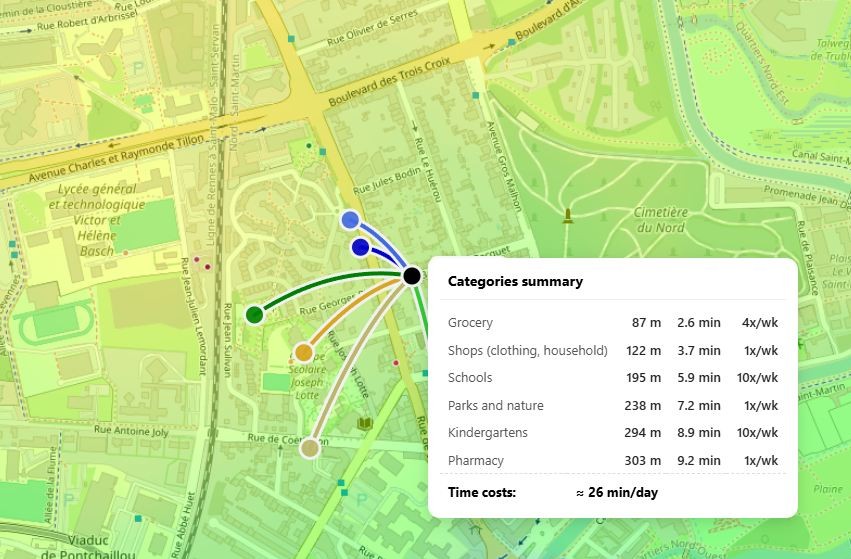
If you want to see the picture at once — try HotMap. It's a geographic information tool that visualizes accessibility of places you need around any point on the map.
You choose categories — pharmacies, schools, parks, cafés, transit — and see a heat map: where everything is nearby, and where the neighborhood is effectively empty.
There's a ready "Quiet and calm" mode — it automatically assesses the balance between comfortable infrastructure and absence of irritants like factories or nightclubs. Convenient if you're looking for a place to live, not to party.
The time cost block shows how many hours per week go to logistics for each object category.
Try it on your neighborhood
In summary
A 15-minute city isn't an architectural style or a political program. It's a quality-of-life criterion: how well a neighborhood is designed for people, not cars.
Good news: it can be measured. Bad news: most neighborhoods don't meet this criterion — and we've simply gotten used to it.
But even understanding this changes perception. You start seeing the city differently: not as a backdrop for life, but as an environment that either works for you or doesn't.
And here's the question that remains after this article:
Frequently asked questions
Can you live in a 15-minute city and still use a car?
Of course. 15-minute accessibility is about availability, not prohibition. The point is that the car becomes a choice, not a necessity. You drive when you want, not when you're forced to.
Are new developments on the outskirts always bad for 15-minute accessibility?
Not always. Some new districts are designed with mixed use and walkability in mind. But more often — no. So it's important to look not at developer renders, but at real infrastructure around.
What matters more: proximity to downtown or 15-minute accessibility?
15-minute accessibility matters more. Downtown can be overloaded, expensive, and uncomfortable for living. A quiet neighborhood 30 minutes from downtown but with pharmacy, school, park, and café within walking distance — that's good environment. Geographic location is secondary.